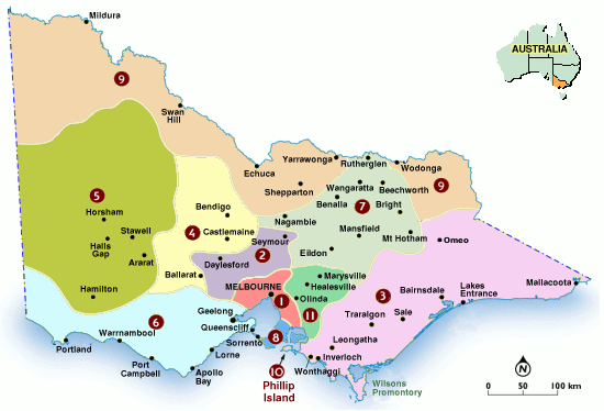
File:Vic region map.png
From GeoWiki
No higher resolution available.
Vic_region_map.png (550 × 374 pixels, file size: 73 KB, MIME type: image/png)
Victorian Regional Map
File history
Click on a date/time to view the file as it appeared at that time.
| Date/Time | Thumbnail | Dimensions | User | Comment | |
|---|---|---|---|---|---|
| current | 19:56, 9 December 2009 | | 550 × 374 (73 KB) | Caughtatwork (talk | contribs) | Victorian Region Map |
| 19:50, 9 December 2009 |  | 500 × 352 (27 KB) | Caughtatwork (talk | contribs) | Victorian Regional Map |
- You cannot overwrite this file.
File usage
The following page links to this file: