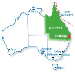
Difference between revisions of "Queensland"
From GeoWiki
(→Geocaching in QPWS Managed Areas) |
(→Geocaching in QPWS Managed Areas) |
||
| Line 14: | Line 14: | ||
The local QPWS will advice you if a formal Application Form is to be lodged or if alternative approval processes apply for that area. | The local QPWS will advice you if a formal Application Form is to be lodged or if alternative approval processes apply for that area. | ||
| + | |||
| + | '''Application Form''' [[http://wiki.geocaching.com.au/images/f/f1/Geocaching_application_form_27July2012.pdf]] | ||
== Queensland Geocaching == | == Queensland Geocaching == | ||
Revision as of 21:25, 8 October 2012
Contents
[hide]Geocaching in QPWS Managed Areas
Queensland National Parks and Wildlife Service have released a Geocaching Policy and associated Geocaching Activity Guidelines which provide to the approval process to place geocaches within land managed by QPWS.
http://www.qorf.org.au/01_cms/details.asp?ID=1710
Policy [[1]]
Guidelines [[2]]
Approval Flowchart [[3]]
Before placing a geocache you should make contact with the local QPWS office seeking advice on the placemenet criteria for that area. The QPWS Park Enquiries team (info@nprsr.qld.gov.au) can provide details of local QPWS contacts.
The local QPWS will advice you if a formal Application Form is to be lodged or if alternative approval processes apply for that area.
Application Form [[4]]
Queensland Geocaching
Please visit the Qld Dashboard to find any new caches in the area and/or geocaching events.Metropolitan Areas
Regional Areas
- Peninsula Region
- Gulf Country Region
- Northern Goldfields and Upper Flinders Region
- Northern Tropical Coast and Tablelands Region
- Herbert and Lower Burdekin Region
- Central Coast & Whitsundays Region
- Capricornia Region
- Capricornia Region
- Central Highlands & Coalfields Region
- Central Western Region
- North Western Region
- Channel Country Region
- Maranoa & Warrego Region
- Darling Downs and Granite Belt Region
- Wide Bay & Burnett Region
