Difference between revisions of "Zones"
(→What are Zones?) |
|||
| Line 9: | Line 9: | ||
* Postcode boundaries | * Postcode boundaries | ||
* Many other uses we haven't though of yet | * Many other uses we haven't though of yet | ||
| + | |||
| + | ''An Example of a zone: Anakie Gorge by caughtatwork:'' | ||
| + | |||
| + | [[Image:Anakie.jpg]] | ||
== How do we use Zones? == | == How do we use Zones? == | ||
Revision as of 14:59, 14 February 2008
| This page contains information specific to Geocaching Australia. |
What are Zones?
Zones are community created geographic regions that can be uploaded to [Geocaching Australia]
These can be used for many purposes, for example:
- Flagging of areas where geocaching is banned or restricted
- Postcode boundaries
- Many other uses we haven't though of yet
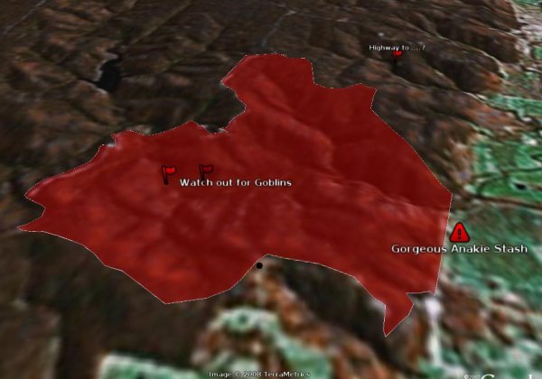
An Example of a zone: Anakie Gorge by caughtatwork:
How do we use Zones?
Currently you will not encounter Zones unless you list a GCA cache that resides withing a restricted area.
Zone information can be viewed here and downloaded in KML format for viewing in Google Earth.
Zones are user contributed, and reviewed by the site admins before being activated to ensure integrity of the database.
Why use them?
At Geocaching Australia, we believe that the hider should have all the information they need ot responsibly hide a self-reviewed cache. If they accidentally try to list it in a known restricted area we strongly suggest they move the cache to a more suitable area.
How can I help?
If you know of an area that caching is off-limits, you can make a zone and upload it to the site.
A tutorial is found here: HOWTO:Add_Zones_to_GCA

