Queensland

From GeoWiki
Revision as of 22:24, 8 October 2012 by Ruzzelz (talk | contribs) (Geocaching in QPWS Managed Areas)
Jump to: navigation, search
QLDimgBrisbaneMap.jpg

Geocaching in QPWS Managed Areas

Queensland National Parks and Wildlife Service have released a Geocaching Policy and associated Geocaching Activity Guidelines which provide to the approval process to place geocaches within land managed by QPWS.

http://www.qorf.org.au/01_cms/details.asp?ID=1710

Policy [[1]]

Guidelines [[2]]

Approval Flowchart [[3]]

Before placing a geocache you should make contact with the local QPWS office seeking advice on the placemenet criteria for that area. The QPWS Park Enquiries team (info@nprsr.qld.gov.au) can provide details of local QPWS contacts.

The local QPWS will advice you if a formal Application Form is to be lodged or if alternative approval processes apply for that area.
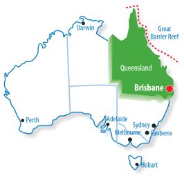
Queensland Geocaching

Please visit the Qld Dashboard to find any new caches in the area and/or geocaching events.

Metropolitan Areas

Brisbane
Gold Coast
Sunshine Coast

Regional Areas

Peninsula Region
Gulf Country Region
Northern Goldfields and Upper Flinders Region
Northern Tropical Coast and Tablelands Region
Herbert and Lower Burdekin Region
Central Coast & Whitsundays Region
Capricornia Region
Capricornia Region
Central Highlands & Coalfields Region
Central Western Region
North Western Region
Channel Country Region
Maranoa & Warrego Region
Darling Downs and Granite Belt Region
Wide Bay & Burnett Region

See Also