Difference between revisions of "Waypoint"
Pickupfamily (talk | contribs) (More info) |
|||
| (10 intermediate revisions by 6 users not shown) | |||
| Line 1: | Line 1: | ||
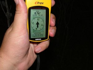
| − | A | + | [[Image:Waypoint.jpg|thumb|left|300px|GPSr at the GZ for the Waypoint it is navigating to.]] |
| + | A [[Waypoint]] is a location on Earth defined by a set of [[coordinates]]. When stored in a [[GPS receiver]], or identified on [[cache page]], a [[waypoint]] is typically referenced by a [[waypoint code]] (or [[waypoint ID]]). | ||
| − | [[ | + | In [[geocaching]], [[traditional cache]]s have a single waypoint - the location of [[cache]] (or [[ground zero]]). |
| − | [[Multi- | + | [[Multi-cache]]s have more than one [[waypoint]], with the final [[waypoint]] being the [[cache]]. |
| + | In cases where a second (or subsequent) [[waypoint]] is found by projecting a bearing and distance from a first [[waypoint]], this is refered to as a [[projected waypoint]] | ||
| + | |||
| + | [[Waypoint]]s in [[geocaching]] are typically two-dimensional, referenced by old [[latitude]] and [[longitude]] [[coordinates]]. [[Altitude]] is ignored, as [[cache]]s are typically at or near ground-level. (This unknown dimension is exploited for sneaky effect in some caches.) | ||
| + | |||
| + | [[Category:Glossary]] | ||
Latest revision as of 22:44, 24 June 2007
A Waypoint is a location on Earth defined by a set of coordinates. When stored in a GPS receiver, or identified on cache page, a waypoint is typically referenced by a waypoint code (or waypoint ID).
In geocaching, traditional caches have a single waypoint - the location of cache (or ground zero).
Multi-caches have more than one waypoint, with the final waypoint being the cache. In cases where a second (or subsequent) waypoint is found by projecting a bearing and distance from a first waypoint, this is refered to as a projected waypoint
Waypoints in geocaching are typically two-dimensional, referenced by old latitude and longitude coordinates. Altitude is ignored, as caches are typically at or near ground-level. (This unknown dimension is exploited for sneaky effect in some caches.)
